HINT: Click [Mark] or tap anywhere on the Map to register Point. Click on existing point to see the related menu.
Map Coordinates module is a Maps with real-time coordinates displayed at the bottom side of the screen. This coordinate will dynamically change following the movement of the map cursor. The coordinates shown are Latitude Longitude, UTM, MGRS and all most commonly used Coordinate Reference System in the World (using selected EPSG Codes).
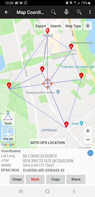
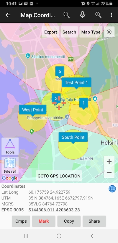
This module can also be used as a tool to search location based on coordinates (from various coordinate reference system), register points / markers which will automatically be stored in a database complete with coordinate data, time of observation, elevation from sea level (premium) and geocoding address (premium). Each marker can be labeled manually with unique label / notes, added photo etc.. Marker style can be changed to display ID or notes / label to make the markers easier to recognize.

To perform a simple spatial analysis, the application equiped with Tools to perform & display complex geometry analysis such as Triangulated Irregular Network / TIN (Delaunay Triangulation), Voronoi Diagrams, Fix Buffers and Convex Hull. These generated geometries can be displayed and hidden according to your wishes, the object will be dynamically change when you add a new marker data on the map or base on cursor movements.
To save measure data to an external file, there is an Export tool which supports KML, GPX, CSV and DXF file formats and stored in local drive.
Read Next:
Marker Map
Add Photo To Your Data