Simple module for measuring level, tilt and slope using the sensors on your mobile device. Simply place your phone on the terrain surface you want to measure the slope of (e.g., a road or ground surface), and the slope will be automatically calculated (in degrees and percent). Suitable for geologists or surveyors who want to measure the slope at a certain point
This module also equipped with an artificial bubble level that can be used as a leveling tool using mobile phone.
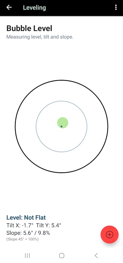
Click the + button to save as coordinates point data; the level, tilt and slope data will be saved as point notes.
Read Next: Import File