UTM Geo Map is equipped with tools to import coordinate data in text (.txt) files, this TXT file must be in Space Delimited format, consisting of Point Name, Coordinates and Elevation, all separated by spaces. Coordinates can be Latitude Longitude, UTM, MGRS or Custom CRS selected during Export or Import process, the coordinates should be following standard as described below.
Since the TXT format is space delimited, make sure there are no spaces in the Point Name column. You can change the space to underscore, for example PT 1 becomes PT_1.
Latitude Longitude
The latitude longitude coordinates must use the WGS84 reference and the elevation units is meters, see picture below.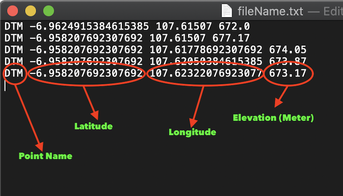
UTM
The UTM coordinates consisting Zone Number, Nort/South hemisphere, Easting, Northing and the elevation units in meters, see picture below.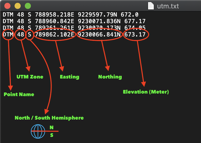
MGRS
The MGRS coordinates is writed in standard MGRS coordinates following with elevation data in meters, see picture below.
Custom CRS
The data must be consisting EPSG Codes, CRS-X, CRS-Y following with elevation data in meters, see picture below.